Understand the high passes on both main roads into Ladakh – from Zojila, Namika La and Fotu La on the Srinagar route to the Atal Tunnel, Baralacha La, Suraj Tal, Gata Loops, More Plains and Tanglang La on the Manali route.
The two classic roads into Ladakh – from Srinagar and from Manali – are defined by their passes. Each crossing is a landmark: a change in landscape, weather and culture. Knowing what to expect at each one helps you plan stops, acclimatise sensibly and enjoy the drive. This guide covers the main passes and landmarks on both routes, from Zojila Pass in the west to Tanglang La near Leh.
Altitudes, distances and opening dates in this guide are approximate. Every figure should be checked against current sources before you travel.
The two routes compared
| Srinagar–Leh | Manali–Leh | |
|---|---|---|
| Main passes | Zojila, Namika La, Fotu La | Baralacha La, Nakee La, Lachulung La, Tanglang La |
| Altitude profile | Gradual, lower overnight at Kargil | Higher passes and higher overnight options |
| Towns on the way | Sonamarg, Drass, Kargil | Keylong, Jispa; seasonal camps beyond |
| Typical duration | 2 days | 2–3 days |
| Main challenge | Zojila's narrow, busy road | Long, remote stretches at high altitude |
Many travellers enter via Srinagar and leave via Manali, so they cross the higher passes once already acclimatised. Our Ladakh road trip itinerary follows this plan.
The Srinagar–Leh route
This route runs from Srinagar through Sonamarg, over Zojila to Drass and Kargil, then east via Mulbekh, Namika La, Fotu La and Lamayuru to Leh. It is generally considered the more gradual way to gain altitude.
Zojila Pass
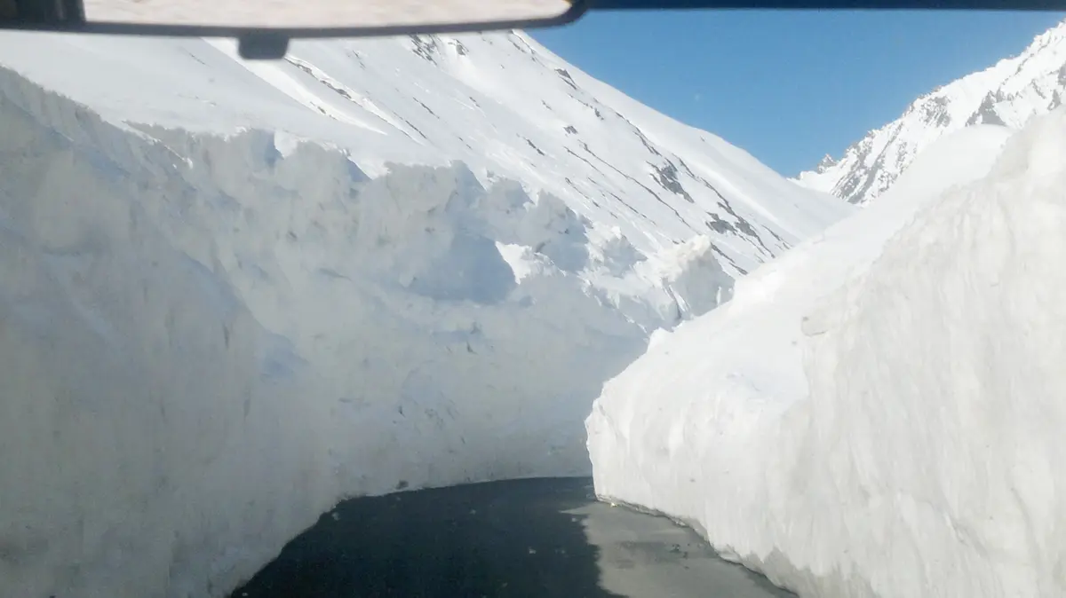
Zojila is the gateway between the green Kashmir valley and the arid landscape of Ladakh. It is not the highest pass in the region, but it is one of the most dramatic, with a narrow road cut into steep slopes. It stands at about 3,528 m.
- Road: narrow, unsealed in places and busy with trucks. Expect delays.
- Season: usually opens in late spring and closes in winter.
- Traffic rules: one-way timings for different directions are sometimes enforced.
Namika La Pass guide
Namika La sits between Mulbekh and Kharbu. The name is often translated as "pillar of the sky", after a prominent rocky peak nearby. It stands at about 3,700 m. The road is generally good, and the pass is an easy stop for photographs.
Fotu La Pass road trip
Fotu La is the highest pass on the Srinagar–Leh highway. It stands at about 4,108 m. On a Fotu La Pass road trip, you climb through open, rolling terrain, with views over layered ranges, before descending in loops towards Lamayuru and the Moonland. Stop briefly at the top and take in the views across the valleys.
Our Lamayuru to Kargil road guide covers this section in detail.
The Manali–Leh route
The Manali route crosses several higher passes and plateaus. It is longer and gains altitude faster, so acclimatisation needs more care. For the road itself, see our existing Manali Leh road trip guide and Manali Leh road condition article.
Atal Tunnel, Manali
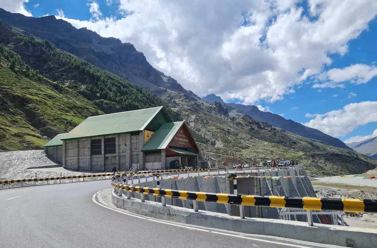
The Atal Tunnel beneath the Rohtang Pass connects the Manali side with Lahaul and has shortened the journey considerably. The tunnel is about 9 km long and opened in October 2020. Vehicles must follow tunnel speed limits and no stopping is allowed inside.
Baralacha La Pass
Baralacha La connects Lahaul with the Sarchu plains. Several rivers rise near the pass, and snow can linger well into summer. It stands at about 4,890 m. Expect slush and water crossings early in the season.
Suraj Tal Lake
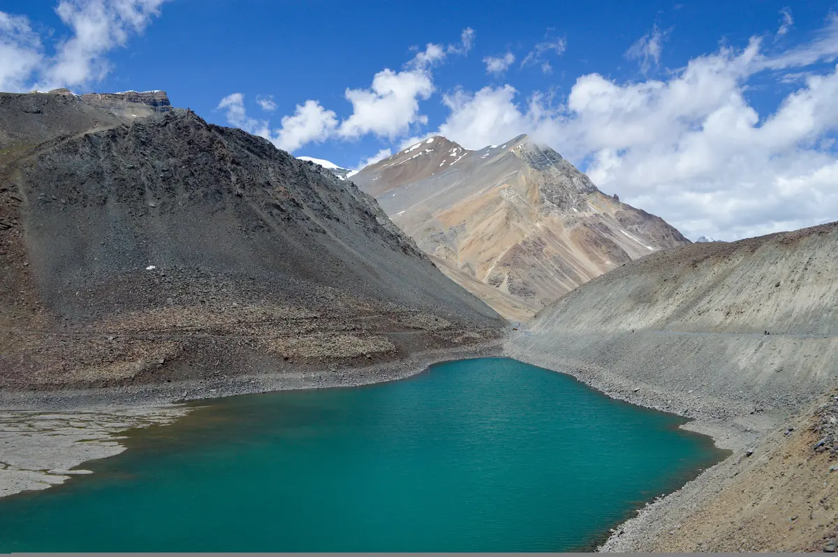
Suraj Tal is a small glacial lake just below Baralacha La, on the Lahaul side. The road passes close by, and the lake is a popular photo stop. Do not walk far from the road if you feel the altitude.
Gata Loops
After Sarchu and Brandy Nala, the road climbs a series of hairpin bends known as the Gata Loops. They are usually counted as 21 bends. The climb is steep, so drive slowly and use low gears.
Nakee La and Lachulung La Pass
Above the loops, the road crosses Nakee La and then Lachulung La Pass, before dropping through narrow canyons to Pang. They stand at about 4,739 m and 5,059 m respectively. Rock formations along the descent to Pang are spectacular.
More Plains, Ladakh
Beyond Pang, the road climbs onto More Plains, a high, flat plateau that stretches for many kilometres. The plateau stretches for roughly 40–50 km at around 4,700–4,800 m. Nomadic herders sometimes camp here in summer. The road is fast, but sand and potholes can surprise you.
Tanglang La Pass
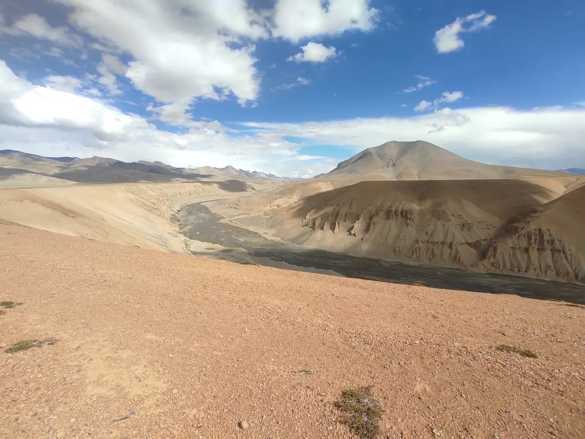
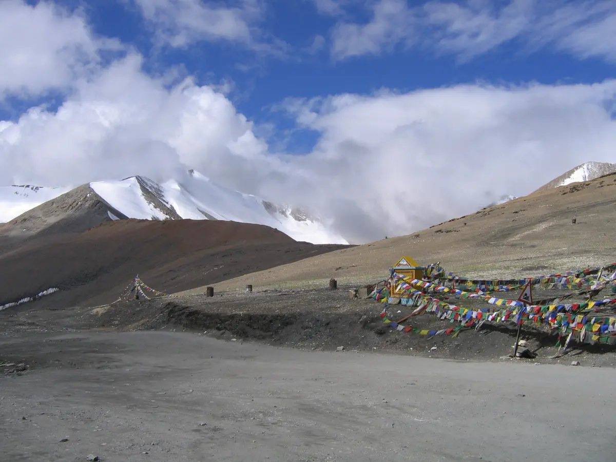
Tanglang La is usually cited as the highest pass on the Manali–Leh highway. Its signed altitude is about 5,328 m. From the top, the road descends to Rumtse, Upshi and the Indus valley, and then on to Leh.
Stops between the passes
The Manali route has long gaps between settlements, so it helps to know where you can stop:
- Keylong and Jispa: the last sizeable stops in Lahaul, with hotels and guesthouses. Jispa is a common overnight halt.
- Darcha: a police check post and the start of the climb towards Zingzingbar and Baralacha La.
- Sarchu: seasonal tent camps on a high plateau.
- Pang: seasonal dhabas for food and tea between Lachulung La and More Plains.
- Rumtse and Upshi: the first villages after Tanglang La, as the road drops towards the Indus.
Driving a high pass: technique
- Use low gears on long descents to save your brakes; avoid riding the brake pedal.
- Give way to uphill traffic on narrow sections where possible, and to army convoys at all times.
- Watch the surface: gravel, ice in the shade and snowmelt streams can appear suddenly.
- Expect reduced power: engines lose power at altitude, especially older carburetted ones.
- Do not overtake on blind bends, and use your horn before hairpins.
- Keep the tank above half on the Manali route, where fuel stops are far apart.
When the passes open
High passes are cleared of snow each spring by the Border Roads Organisation, and close again with heavy snowfall in autumn or early winter. Zojila usually opens before the Manali route's higher passes. Exact dates vary each year with snowfall and are announced locally. See our best time to visit Leh Ladakh guide for seasonal planning.
When a pass is closed
Passes close temporarily for snowfall, landslides, avalanches, roadworks or security reasons. If you reach a closure, follow instructions from the police, army or BRO staff, and do not try to find a way around. Ask how long the closure is expected to last; sometimes it is a matter of hours, sometimes days. Keep enough fuel, food, water and warm clothing to wait comfortably, and know where you could stay overnight if needed – Sonamarg, Drass and Kargil on the Srinagar route, or Keylong, Jispa and Leh on the Manali route.
Other passes within Ladakh
- Khardung La: on the road from Leh to Nubra. See our Leh sightseeing guide.
- Chang La: on the way to Pangong.
- Umling La: in south-eastern Ladakh. See the Umling La travel guide.
Passes at a glance
| Pass or landmark | Route | What it is known for |
|---|---|---|
| Zojila | Srinagar–Leh | Gateway from Kashmir; narrow, busy road |
| Namika La | Srinagar–Leh | Striking rock peak nearby |
| Fotu La | Srinagar–Leh | Highest point on this highway; views towards Lamayuru |
| Atal Tunnel | Manali–Leh | Bypasses Rohtang Pass |
| Baralacha La | Manali–Leh | Lingering snow; Suraj Tal nearby |
| Gata Loops | Manali–Leh | Series of hairpin bends |
| Lachulung La | Manali–Leh | Followed by canyons towards Pang |
| More Plains | Manali–Leh | Long, flat high plateau |
| Tanglang La | Manali–Leh | Usually cited as the highest on the highway |
Photography on the passes
Prayer flags, cairns and signboards make every pass a photo stop, and it is easy to lose track of time. Keep stops short, park well off the road – never on a bend – and watch for traffic when crossing. Snow and bright sun can fool camera meters, so check your exposures. Respect any signs prohibiting photography near military posts.
Safety tips for crossing high passes
- Acclimatise: do not rush high passes on your first days.
- Stop briefly: limit time at the top of high passes to 10–20 minutes.
- Start early: mornings usually have better weather and less snowmelt.
- Check vehicles: brakes, tyres and fuel before each high section.
- Carry warm clothes: temperatures drop quickly with altitude.
- Follow BRO and police instructions: closures happen for good reasons.
Read more in our altitude sickness and acclimatisation guide.
What to carry for a day over the passes
- Warm layers within reach: down jacket, hat and gloves
- Sunglasses and sunscreen – snow and altitude intensify the sun
- Water, snacks and a packed lunch for long, remote stretches
- A basic first-aid kit and personal medicines
- Printed permits and ID for checkpoints
- Offline maps and a power bank
See our Ladakh packing list for a complete checklist.
Plan your route
For day-by-day plans on each road, see our Srinagar to Leh bike trip guide and Manali–Sarchu–Leh bike trip guide. Riders heading over from Manali may also find our Manali to Leh by bike article useful.
Tripsdoc's Leh Ladakh packages include routes via both Manali and Srinagar; check each package page for the route. For help choosing a road, contact Tripsdoc.
Final thoughts
Each pass on the roads into Ladakh marks a step deeper into the mountains. Travel with patience, respect the altitude, and you will remember the crossings as some of the best moments of your trip.
Photo credits (Wikimedia Commons): Timothy Gonsalves (CC BY-SA 4.0), Anwaraj (CC BY-SA 3.0), Jagseer S Sidhu (CC BY-SA 4.0), PKD16 (CC BY-SA 4.0), No machine-readable author provided. Deeptrivia assumed (based on copyright claims). (CC BY-SA 3.0).
Frequently Asked Questions
Tanglang La is usually cited as the highest pass on the Manali–Leh highway. Check the latest signed altitude, as published figures vary.
The Srinagar route usually climbs more gradually, with overnight stops at lower altitudes such as Kargil, which many travellers find easier than the Manali route.
No. Snow closes the high passes for much of the winter. Opening and closing dates vary each year depending on snowfall and clearance work.